Goals: Data from seismic stations can be used to image the Earth's interior using methods similar to those used in CAT scans and ultrasound images. In the Earth, we use seismic waves created by earthquakes as our X-rays, and our seismometers as X-ray plates. Seismic imaging of the structures beneath Colombia will help us to understand how Colombian geology and tectonics evolved over time by providing the story with a definitive and detailed end point - in other words, what ever processes happened in the past, they ultimately culminated in the structures that we observe today.
More specifically, our study will allow us to get detailed images of both the flat slab today and the normally dipping plate. We will be able to learn about the overriding continental plate in these regions as well, which will help us to understand the role flat slab subduction has in the evolution of continents in general. This work will dovetail closely with the geochemistry, as we will be able to compare the structures we see today within and above the modern flat slab, and the materials erupted over the past 4 Ma south of the flat slab that may have brought similar materials to the surface with them. Constraints we can place on the thickness of the overriding crust will help us to compare the relative roles of gravity (buoyancy) and mantle flow dynamics on the formation of mountain belts over time. We will also be able to study how subduction fluxes water through continental material by looking for evidence in the seismic record of hydrous materials.
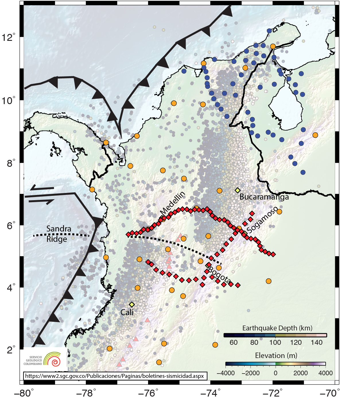
Deployment: We will install 70 seismic stations in three transects as shown in the map below (station locations are approximate at this time). These stations will complement the already extensive seismic network installed and operated by the Servicio Geologico Colombiano (SGC). Each station will run independently for two years, during which time we will return at regular intervals to check on the equipment and collect data. We hope to complete the installation of our seismic network in the summer, 2020, and will demobilize the equipment in summer, 2022.